
EO: the visible-light camera
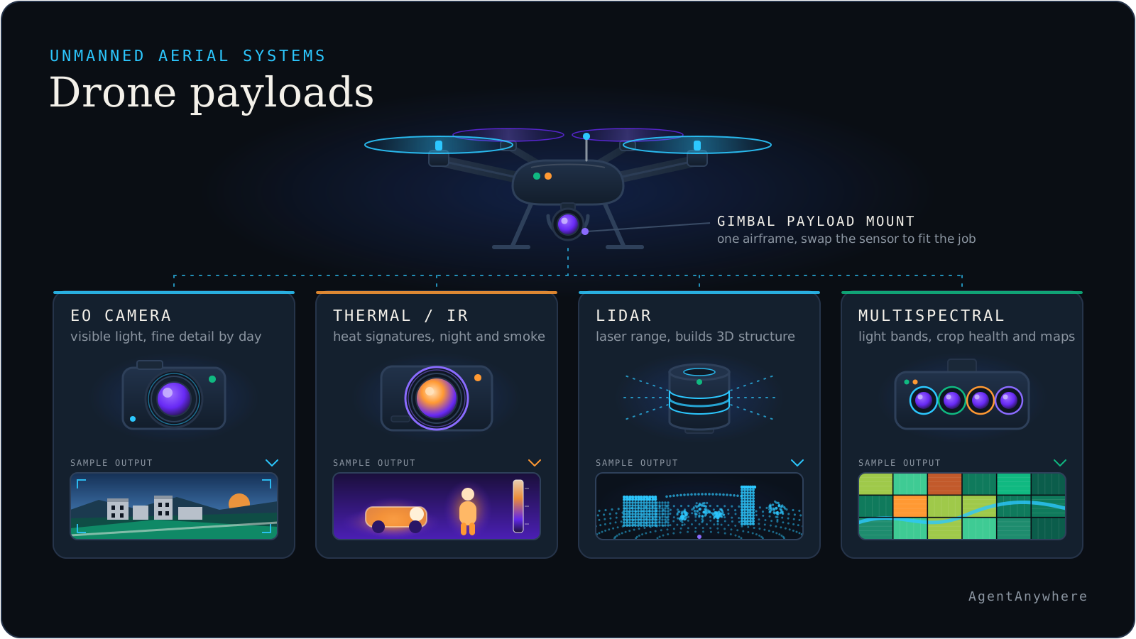
An EO payload is a visible-light camera, usually on a stabilised gimbal, and it is the default sensor for drone work.
An electro-optical (EO) payload is a camera that captures light in the visible range, often with a zoom lens. It is the most common drone sensor, and for good reason: it produces the images people understand instantly, at high resolution, at relatively low weight and cost. Inspection, mapping, filming and surveillance all start with an EO camera.
Most serious EO payloads are mounted on a gimbal: a stabilised, motorised mount that keeps the camera steady and pointed where the operator wants despite the aircraft's vibration and movement. Gimbal quality often matters as much as the camera, since a sharp sensor is no use if the image is blurred.
The limits are the limits of light. EO needs enough illumination, so it struggles at night and in low light. It cannot see through smoke, dense fog or heavy cloud, and it is easily confused by glare and shadow. It sees surfaces, not what is behind them, and it gives only a flat picture unless the images are combined into a 3D model through photogrammetry.
IR and thermal: seeing heat
Thermal imagers sense heat rather than light, so they work in complete darkness and show temperature differences.
Infrared is a broad family of wavelengths beyond visible red. In drone work it usually means two things. Thermal imaging (long-wave infrared) senses the heat that every object radiates, so it needs no illumination: it works in complete darkness and highlights anything warmer or cooler than its surroundings. Near-infrared sits just beyond visible light and is used mainly in agriculture and vegetation monitoring.
Thermal is the sensor of choice when the thing you care about is a temperature difference: a person in a field at night, a hot spot on a solar panel, a failing joint on a power line, heat leaking from a roof, a fire's edge through smoke. Thermal imagers generally have lower resolution than visible cameras and produce softer images, so they are often paired with an EO camera for detail.
A distinction worth knowing: a radiometric thermal camera measures actual temperature at each pixel, and a non-radiometric one only shows relative differences. For inspection work where the temperature itself matters, radiometric is the one that counts. Thermal also has its own blind spots: it reads surface temperature, struggles with shiny surfaces that reflect heat from elsewhere, and can be washed out when everything is at a similar temperature, such as under midday sun.
LiDAR: measuring shape with light
LiDAR stands for light detection and ranging. A LiDAR payload fires rapid laser pulses and times how long each takes to bounce back, giving the distance to whatever it hit. Millions of these measurements, combined with the aircraft's own position and orientation, build a point cloud: a precise 3D model of the terrain and everything on it.
Because LiDAR is active, bringing its own light, it works in darkness and is unaffected by shadows. Its signature strength is vegetation: some pulses pass through gaps in foliage and reach the ground, so LiDAR can map terrain under tree cover where cameras cannot see it. That makes it valuable for forestry, corridor mapping, flood modelling and surveying power-line routes.
The trade-offs are cost, weight and data. LiDAR payloads are generally heavier and pricier than cameras, which affects the aircraft and its endurance, and a point cloud is a large dataset that needs processing. LiDAR gives geometry rather than colour or temperature, so it is usually combined with a camera that supplies the colour. Dense rain, fog and highly reflective or absorbing surfaces can also degrade the returns.
Payloads compared
The common payload types side by side. Real sensors vary widely in quality, so read this as a guide to what each kind of sensor does well, not a ranking.
| Payload and what it senses | Strengths | Limits | Typical uses |
|---|---|---|---|
| Payload and what it senses: EO (visible camera): visible light. | Rich detail, low cost and weight, images people read at a glance. | Needs light and a clear view. Weak at night, in smoke and in glare. | Inspection, mapping, filming, general surveillance. |
| Payload and what it senses: Thermal (long-wave IR): heat radiated by objects. | Works in darkness, shows temperature differences, sees through some smoke. | Lower resolution, little fine detail, confused by reflective surfaces. | Search and rescue, fire, electrical and solar inspection, night observation. |
| Payload and what it senses: Multispectral / near-IR: selected bands beyond visible light. | Shows plant stress and surface differences invisible to the eye. | Specialised. Needs calibration and expertise to interpret. | Agriculture, forestry, environmental monitoring. |
| Payload and what it senses: LiDAR: distance, by timing laser pulses. | Precise 3D geometry, works in the dark, can map ground under foliage. | Heavier and costlier, no colour, large datasets, degraded by dense rain or fog. | Terrain and corridor mapping, forestry, volume measurement. |
| Payload and what it senses: Other payloads: gas, radio signals, radar returns, or cargo and equipment. | Specialised capabilities for a specific task. | Task-specific. Add weight and power draw. | Gas leak detection, communications relay, delivery. |
How to choose a payload: what do you need to tell apart?
Pick the sensor by the difference you need to see, not by the price tag. If the answer lies in colour, texture or fine detail, start with an EO camera. If it lies in temperature, use thermal. If it lies in height and shape, or in the ground under trees, use LiDAR. If it lies in plant health, use multispectral. Where one sensor leaves a gap, pair it with another: we call this pairing by blind spot.
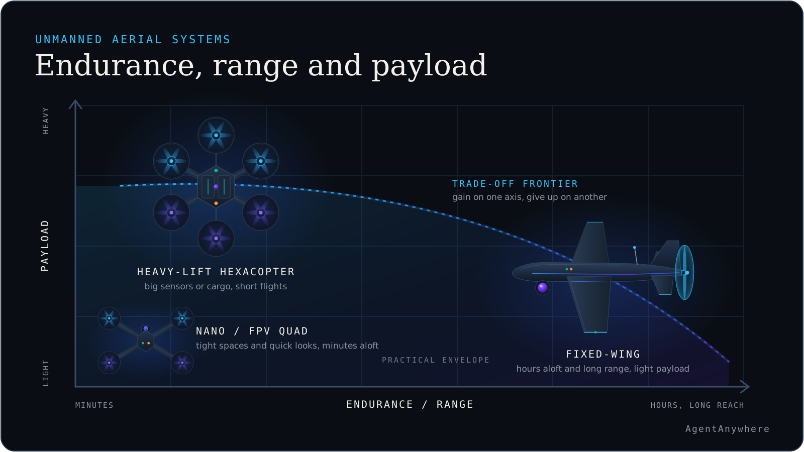
Common mistakes. Judging a thermal camera by its resolution alone, when radiometric measurement is what matters for inspection. Expecting a visible camera to work at night or through smoke. Ordering a LiDAR without planning for the processing of the point cloud. Choosing the sensor first and discovering the aircraft cannot carry it for long enough, which is why endurance, range and payload capacity belong in the same decision.
For worked examples, see how a colour and thermal pair is used in solar plant inspection, and how the same sensors are described on our page on AI for drones and UAVs.
Combining payloads, and where AI helps
The most useful systems rarely rely on one sensor. A common combination is a dual EO/IR gimbal: a visible camera and a thermal imager side by side, so an operator can switch between detail and heat, or overlay them. Mapping drones often add an RGB camera to a LiDAR so the point cloud can be coloured. Each pairing works because one sensor's weakness is the other's strength.
Combining sensors also multiplies the data. A single flight can produce thousands of images and a dense point cloud, far more than a person can review. This is where on-device AI earns its place: models running on the aircraft's companion computer or the ground station can scan imagery as it arrives, highlight frames or regions that look unusual, and queue them for a person to examine, without needing to send everything to a distant server first.
AgentAnywhere works on edge AI and perception for this observe-and-assist role: the model points at what may matter, with the reason, and a person makes the call. The sensor, in other words, extends what the operator can see, and the AI helps them look at the right part of it. Payload weight and power draw also feed directly into endurance, range and payload capacity.
More in this series
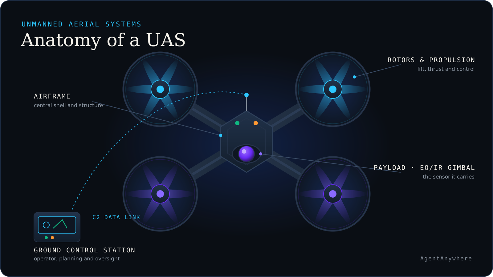
What is an unmanned aerial system?: the aircraft, the control station, the link and the people: the whole system.
UAV vs UAS vs drone: what each word actually covers, and why the difference matters.
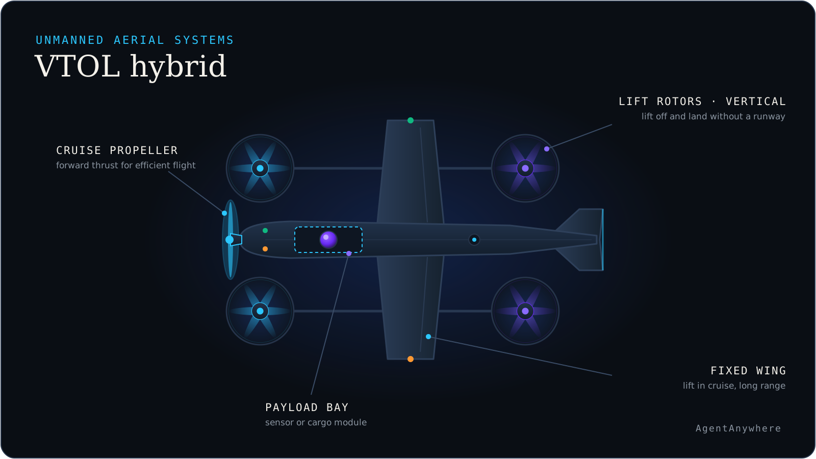
Fixed-wing vs multirotor vs VTOL: three ways to stay in the air, and what each one trades away.
Types of military and industrial drones: the main categories by size and by job, described neutrally.
Endurance, range and payload capacity: the three numbers on every spec sheet, and why they pull against each other.
Frequently asked questions
What is a drone payload?
A drone payload is the equipment a drone carries to do its job, as distinct from the aircraft itself. For most missions it is a sensor such as a camera, thermal imager or LiDAR, but it can also be a cargo box, a sprayer, a radio relay or a gas sensor. The payload largely determines what the flight is for.
What does EO/IR mean on a drone?
EO/IR means electro-optical and infrared. An EO/IR payload combines a visible-light camera, the electro-optical part, with a thermal or infrared imager, usually on a stabilised gimbal. It lets the operator see detail in daylight and heat signatures in darkness or through some smoke, and to switch between or overlay the two views.
What is the difference between an infrared and a thermal camera?
Infrared is the broad family of wavelengths beyond visible red light. A thermal camera is a specific kind of infrared camera, working in the long-wave band, that senses heat radiated by objects and so needs no light. Near-infrared cameras work closer to visible light and are used mainly for vegetation monitoring. In drone work, infrared usually means thermal.
What is LiDAR used for on drones?
LiDAR measures distance by timing laser pulses and builds a precise three-dimensional point cloud of terrain and structures. Drones use it for mapping terrain and corridors, forestry, surveying and volume measurement. Because some laser pulses pass through gaps in foliage, it can map the ground beneath tree cover where cameras cannot see.
Can a drone carry more than one sensor?
Yes. Many drones carry combined payloads, such as a dual EO/IR gimbal with a visible camera and a thermal imager, or a LiDAR with a colour camera so the point cloud can be coloured. Each added sensor adds weight and power draw, which reduces endurance, so payload and flight performance are chosen together.
Written by
AgentAnywhere Research
The team that builds the platform and the models
AgentAnywhere Research writes about the platform, the model families and the trust layer we build and run in India. Where a figure is ours, it says what it covers; where something is a demonstration, it says so.